The Cares Route and Bulnes: Walking the Divine Gorge, the Funicular and the Naranjo de Bulnes
In the heart of the Picos de Europa, the river Cares has cut a gorge so deep and narrow that for centuries the villages at either end were almost cut off from each other. Today a path runs along the canyon wall, carved into the rock high above the river, through tunnels and across bridges, with limestone walls rising on both sides. It is one of the most famous walks in Spain.
Nearby, a funicular hidden inside the mountain climbs to Bulnes, a village that had no road, beneath the Naranjo de Bulnes, the most famous peak in the range. This guide covers the Cares route — its history, how to walk it and how to stay safe — the Bulnes funicular and village, the Naranjo, and the Cabrales cheese that matures in the caves of the same valleys.
The Cares route at a glance
- The Cares route (PR-PNPE 3) is 12 km one way from Poncebos to Caín; walking on to Posada de Valdeón makes about 21 km.
- The Cares route from Poncebos to Caín is 24 km there and back; the hardest part is a 2.5 km climb at the start.
- A there-and-back day takes 6–8 hours; at a good pace, Poncebos to Caín takes 2.5 hours.
- It is the busiest path in the Cantabrian mountains, walked by about 300,000 of the more than two million people who visit the park each year.
- The route is also known as the Divine Gorge (Garganta Divina).
The river itself is small: the Cares is a short mountain river of just 54 km, yet the path along its gorge is counted among the finest walks in the country.
Why it is so popular
Part of the appeal is the scenery, and part is that almost anyone reasonably fit can do it. Its spectacular setting, low altitude, which avoids the harsh weather of the high mountains, and moderate gradient make it ideal for walking and one of the most beautiful footpaths in Spain. Unlike the high routes of the Picos, it needs no climbing skills, no navigation beyond following the path and no mountain equipment — just stamina, water and a head for heights.
That accessibility is also why it can be crowded. On summer weekends, a steady stream of walkers moves in both directions, and the narrow sections can feel busy. An early start, or a weekday visit outside the peak months, makes a real difference.
A path built for a canal
The Cares path was not made for walkers. Its story is one of hard, dangerous engineering.
Before the path
Before the path, the only link between Poncebos and Caín was a route of more than 100 km around the mountains. The gorge itself was all but impassable.
The canal
The first path was cut into the rock between 1915 and 1921 while building a canal to the Camarmeña forebay, which drops 230 m to the Poncebos hydroelectric plant. The canal runs alongside the path for much of the way. The work was perilous: about 500 people built the canal and path, and 11 died in accidents.
The walkers’ path
The path was widened to about two metres between September 1945 and June 1950. From a narrow maintenance ledge it became the route walked today.
The 2011 rockfall
The gorge is still alive. A rockfall in 2011 closed a section; a cantilevered walkway was built and the path reopened on 1 July 2012.
The villages at each end
- Poncebos, in Asturias, is the northern end: the hydroelectric plant, the start of the climb to the cols and the lower station of the Bulnes funicular.
- Caín, in León, is the southern end. At Caín the gorge closes in and the path crosses it by a bridge. It is the natural lunch stop for walkers coming from Poncebos.
- Posada de Valdeón, further south, is where the old route historically began; walking on to Posada de Valdeón makes about 21 km from Poncebos.
The path was more than a curiosity for these villages: the route was once the only link between the two villages when winter snow blocked the mountain passes.
What you will see
- The walls. Sheer limestone rising far above the path on both sides. The grey limestone of the gorge is full of hollows, some used to shelter the sheep that graze there.
- The river. Clear green water far below, glimpsed through the gaps in the rock.
- The canal and tunnels. The old waterworks that made the path possible, and the tunnels near Caín.
- Wildlife. Chamois live on the crags, and overhead you may see the park’s great raptors: more than 100 bird species include the black woodpecker, capercaillie, griffon vulture and golden eagle.
Walking the Cares
Which direction?
Most walkers start from Poncebos in Asturias, walk to Caín in León and come back the same way. Starting from Poncebos means the hardest part comes first: the first 2.5 km climb to the cols, after which the path is practically level. Starting from Caín, the spectacular narrow section of the gorge comes early, and the climb is saved for the descent at the end.
What the path is like
- The path averages 1.5 m wide and often skirts big drops above the river.
- Where the gorge narrows, the path runs through tunnels cut in the rock, with window-like openings, so no torch is needed.
- The path has no particular technical difficulty beyond keeping away from the edge, but needs the fitness for a full day’s walk.
After the initial climb from Poncebos, the path follows the canal along the canyon wall, crossing the river by bridges as the gorge twists towards Caín. The final section, where the walls close in, is the most dramatic.
How long it takes
Allow a full day. A there-and-back day takes 6–8 hours; at a good pace, Poncebos to Caín takes 2.5 hours. Add time for photographs, lunch in Caín and rests in the shade.
Going one way
If you would rather not walk back, you can return from Caín to Poncebos by 4x4 along roads and forest tracks. It is a long drive around the mountains — the same detour that once made the path so important — but it saves the return walk.
Staying safe
The Cares is easy by mountain standards, but it demands respect.
- Falling rocks. The Cares route runs through a karst massif where rocks constantly break loose and can fall from hundreds of metres above. Do not linger under loose walls, and follow any closures.
- The edge. Much of the path is open on the river side. Keep children close and stay on the inside of the path.
- Water. Springs outside the villages are classed as water without health control, so carry plenty of your own.
- Company. Plan walks, check the forecast and never walk alone, or leave word of your route.
- Heat. The gorge traps the sun in summer. Start early, carry sun protection and rest in the tunnels’ shade.
Bulnes and the funicular
A mountain village
Bulnes sits in a high valley above Poncebos, beneath the Naranjo de Bulnes. Bulnes is in two parts: Bulnes de Arriba (Barrio del Castillo) and Bulnes de Abajo (La Villa). Its stone houses, streams and meadows, ringed by mountains, feel far from the modern world.
The funicular
Today a funicular climbs to Bulnes through a tunnel inside the mountain, starting in Poncebos, near the start of the Cares route.
- The funicular runs 2,227 m inside the mountain, climbing 402 m in about 7 minutes at 6 m/s; each car seats 28.
- It runs every half hour: 10:00–22:00 in high season (in 2026 including 1 June–12 October) and 10:00–19:00 in low season.
- The Bulnes funicular costs €17.61 one way and €22.16 return; children aged 4 to 12 pay €4.32 one way and €6.71 return.
- Tickets bought online must be exchanged for a ticket at the funicular entrance.
Many visitors ride up and walk down, or walk up and ride down, to see the valley from both angles. Either way, leave time to wander both halves of the village, sit by the stream and take in the view of the peaks around it before heading back down.
The Naranjo de Bulnes
The mountain
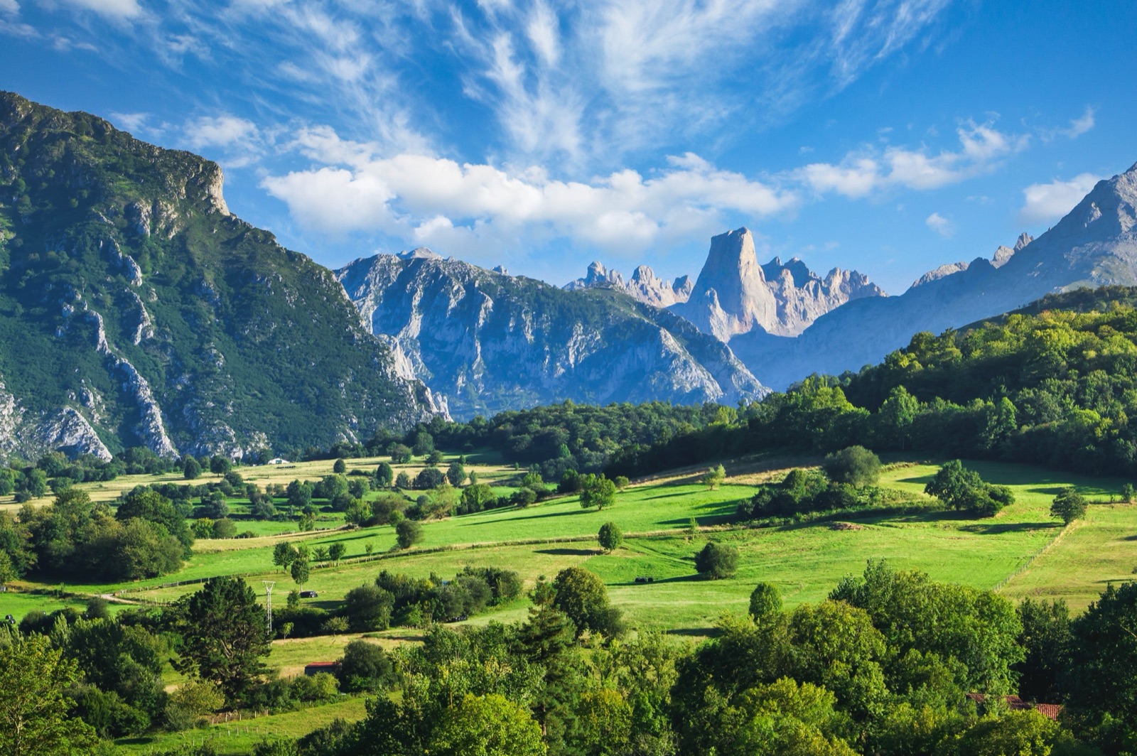
The Naranjo de Bulnes is the symbol of the Picos de Europa: a sheer tower of limestone rising above the surrounding peaks. The Naranjo de Bulnes (Picu Urriellu) rises to 2,519 m, and its west face is a vertical wall of 550 m. That wall is one of the great challenges of Spanish climbing.
The first ascent
It was first climbed on 5 August 1904, by the north face, by Pedro Pidal, Marquis of Villaviciosa, with the shepherd Gregorio Pérez, ‘El Cainejo’.
Seeing it
You do not need to climb it to admire it. The peak is visible from the approaches to Bulnes and from viewpoints around the valley, and it is the backdrop to many walks in the central massif.
Cabrales cheese
The valleys around Poncebos and Bulnes are the home of Cabrales, one of Spain’s great blue cheeses, and a cave visit is a popular part of a day here.
- Cabrales cheese matures in natural caves used individually or jointly, and cave rights are often handed down through generations.
- It is made by hand from raw cow’s milk or a mix of cow’s, sheep’s and goat’s milk.
- It is made in the Cabrales municipality and three neighbouring villages of Peñamellera Alta.
- The Cabrales Cheese Fair is held in Arenas de Cabrales on the last Sunday of August.
The caves are as much a part of Cabrales as the milk, which is why a visit to one is the highlight of a cheese tasting here.
The tour
If you are staying in Oviedo or elsewhere in Asturias without a car, a day tour covers Poncebos, the funicular and a cheese cave in one outing.
Bulnes with the funicular and a Cabrales cheese cave. From Oviedo along the Cares river to Poncebos, the funicular up to Bulnes village beneath the Picu Urriellu, then a Cabrales cheese cave and tasting. The funicular ticket is included. About 8–12 hours.
The tours page lists it with live prices.
Planning your days
One long day
- Early: start the Cares from Poncebos, tackling the 2.5 km climb while it is cool.
- Late morning: reach Caín after about 2.5 hours at a good pace; lunch in the village.
- Afternoon: walk back to Poncebos, or return by 4x4.
- Late afternoon: if energy remains, take the funicular up to Bulnes for an hour in the village.
Two easier days
- Day one: the funicular to Bulnes, a walk around both halves of the village and a cheese cave in the afternoon.
- Day two: the Cares route, at your own pace, from Poncebos or from Caín.
When to go
- Summer brings long days and the most walkers; this is the busiest path in the Cantabrian mountains, so start early to enjoy it in relative peace, and carry extra water for the heat.
- Spring and autumn are ideal: cooler air, fewer people and, in autumn, colour in the trees on the slopes.
- Winter can be beautiful but short-dayed and cold, and rockfall risk is a constant: check conditions before setting out.
Whatever the season, the funicular to Bulnes runs every half hour, from 10:00, with longer hours in high season.
Combining with the rest of the park
The Cares and Bulnes are in the central massif. The Lakes of Covadonga lie to the west, above Cangas de Onís, and the Fuente Dé cable car to the south-east, in Liébana. See our guides to the Lakes of Covadonga and Fuente Dé, Potes and Santo Toribio to build a longer trip.
What to pack
- Water, more than you expect to need; springs are not tested.
- A packed lunch, or money for lunch in Caín.
- Sun protection: hat, sunglasses and cream.
- Shoes with grip and a light layer.
- Your funicular ticket, if booked online, to exchange at Poncebos.
Practical tips
- Start early, for cooler walking and fewer people in the gorge.
- Carry at least two litres of water per person in summer and a packed lunch.
- Wear shoes with good grip; the path is rocky.
- Bring a layer; the gorge can be cool in the morning and in the shade.
- Check for closures before you go; rockfalls can shut the path.
- Buy funicular tickets in advance in high season, and remember to exchange them at the entrance.
With children
The Cares can be done with older children who are used to walking, but the drops beside the path mean constant attention is needed; turning back after the most spectacular section is a good option. The funicular to Bulnes is an easy, exciting outing for all ages, and children aged 4 to 12 pay €4.32 one way and €6.71 return.
Accessibility
The Cares route is not suitable for wheelchairs or anyone unsteady on their feet: it is a long, rocky mountain path beside unprotected drops, with a steep climb from Poncebos. The Bulnes funicular is the easiest way to experience the mountains here without a long walk, although the village itself is a place of uneven stone lanes and slopes.
Frequently asked questions
How long is the Cares route?
12 km one way from Poncebos to Caín, 24 km there and back. Walking on to Posada de Valdeón makes about 21 km one way.
How long does the Cares route take?
A there-and-back day takes 6–8 hours; at a good pace, Poncebos to Caín takes 2.5 hours.
Is the Cares route difficult?
It has no particular technical difficulty, but it needs the fitness for a full day’s walk. From Poncebos, the hardest part is the 2.5 km climb at the start; the path is often beside big drops.
How much is the Bulnes funicular?
€17.61 one way and €22.16 return; children aged 4 to 12 pay €4.32 and €6.71. The ride takes about 7 minutes.
How high is the Naranjo de Bulnes?
2,519 m. It was first climbed on 5 August 1904 by Pedro Pidal with the shepherd Gregorio Pérez, ‘El Cainejo’.